This morning I got the strange idea to practice riding on gravel and dirt roads with the PC800. After procuring some maps from the local Forest Service office and requisitioning two one gallon gas cans, I set off on an adventure. My original goal was to navigate some sketchy back Forest Service roads to reach Deadwood, Oregon via Paris, Oregon. In the end I took a wrong turn and thought I was somewhere else. It turns out I made it to Paris but didn’t realize it. It’s probably a good thing because otherwise I’d still be out there riding, trying to get back to Corvallis.
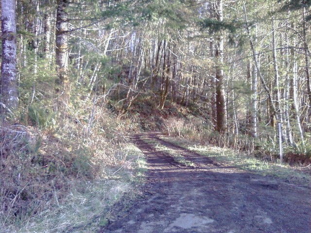
About five or six miles of the route was on “road” that was overgrown with brush and only demarcated by the cut in the hillside and by two ruts from trucks that had passed that way long ago. From the looks of things, I was the first vehicle down this sketchy road since at least the fall. Once I decided to commit to it there wasn’t much turning back. The road was too narrow to turn around on and even if I had, I wasn’t convinced I’d get enough traction in the mud to go uphill.
Coming down out of that mud and mess I found a nice paved road that I decided not to take. My map said the road didn’t exist. Pro-tip to anyone venturing into the Siuslaw National Forest: the forest maps that the Forest Service sells are crap. Get the BLM map of the area for more detail. Carry the Forest Service map though, too, because sometimes the two maps don’t agree. In fact, after getting off the county roads and onto the forest roads, the two maps were either at odds or one or the other simply didn’t have a road listed on it.

The shittastic road I came down. This view makes it look nice and passable. Let me tell you: It wasn’t.

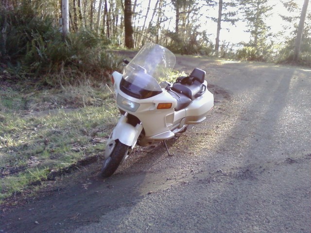
The Tardis parked while I try to figure out why I can’t figure out where I am on any map.
After riding up another dirt road I found myself in the middle of a logging operation and decided I should probably turn around rather than try to get the PC800 with its street tires and street shocks through a muddy mess. The ruts from the logging trucks were a foot to two feet deep.
Back down the paved road I found another paved road. There weren’t any signs. This road wasn’t on my map either. I decided to go left. After a while, two trucks full of chopped wood passed going the other way. They looked like backwoods loggers getting off work at the end of the day. And they waved and smiled at me *real* big. I decided they probably knew the way out and I should follow them. That or I was going to find some people who like to hear people squeal like pigs.
Some time and several sketchy small settlements (the kids didn’t all look quite right and the adults weren’t all there either) later I found myself out on Highway 36 about 20 miles outside of Alsea. In the end I was lucky enough to have a good sense of direction and to remember the cardinal rule of travel in the Siuslaw: When in doubt, follow the water downhill. Eventually it either ends up at the ocean or in the valley.
The ride was about 140 or 150 miles give or take. My odometer and Google Maps disagree on the matter. I’m guessing that their map info isn’t 100% accurate out in the middle of nowhere. Also while I did buy gasoline, I can’t calculate my fuel economy because I didn’t catch how much gas I had put in before I filled up the two gas cans. Next fill-up I’ll figure that out. The gas cans came with me as a precaution in case I got to the very end of the route to find a tree across the road or whatever. That way I knew I could make it out one way or another.
Another minor note: My Heat Troller seems to be malfunctioning. Tomorrow or Thursday I am going to have to take a look to figure out why I couldn’t get heat out of my gloves this evening.
And for those who were hoping to here about banjos and chainsaws in an explicit sense, sorry. No such luck. The banjos and chainsaws were in metaphor only. But had I stopped and asked, I’m sure several of the people along the way had one or the other in the back of their pickup trucks right next to the sawed off shotgun.
One final word: Every time I go for a ride on my PC800 it is like falling in love with motorcycling all over again. Along big boulevards, down freeways, twisting through country roads, up and over mountains on forest roads, down logging paths through the muck and grime… no matter what I throw at this bike it keeps on working and is as happy as can be. Honda got it RIGHT with this design. Say what you will about its looks (I think it’s beautiful), but never say that this bike can’t perform. And further, worrying about a breakdown is at the very far back of my mind. The PC800 just goes and goes and goes. I’m so happy with my bike 🙂
NOTE: It seems that Google Maps has decided to screw up the route map that I traced out. Dunno why it’s doing that. Anyway you get the general idea of the route. The only thing that shouldn’t be there is the small loop down near Paris, Oregon.
