Editor’s note: I am preserving Leland Sheppard’s PC800-related content after his passing. This is one of his pages that I felt the PC800 community would want to have preserved. Leland may be on his final Iron Butt ride but he is not forgotten.
Date of trip: I have taken this trip a number of times, both solo (one day) and two up (two day with a stay at Lee Vining overnight). You can only take this trip from late May (if the winter snow was light, otherwise Tioga will still be closed) until the middle of October. Before and after that, one or more of the passes (particularly Tioga) are likely to be closed. There is a link to Cal Trans Road Information at the bottom of this page.
The route:
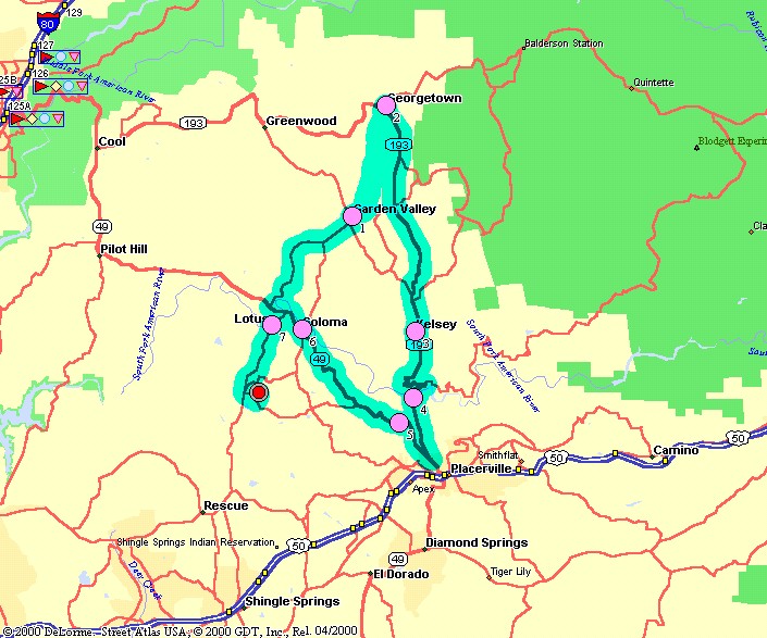
Starting from Placerville, head east on US 50.
Take the Sly Park Exit in Pollock Pines. Turn right (south) at the foot of the ramp onto Sly Park Road.
Continue on Sly Park Road for five miles past Jenkinson Lake/Sly Park Reservoir to the junction with Mormon Emigrant Trail. Turn left (east) on Mormon Emigrant Trail.
Stay on Mormon Emigrant Trail until it dead ends at the junction with CA88. (Warning: This stretch is about 33 miles with NO services of any kind.) Turn left (east) on CA88.
Continue on past Silver Lake, Kirkwood and a real little gem, Caples Lake:

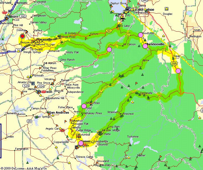
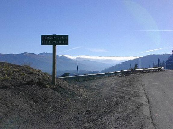
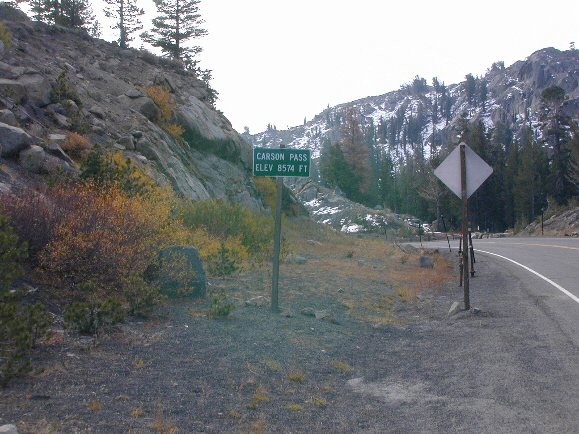
Continue on CA88 over Carson Pass, past Red Lake, through Hope Valley, past the junction where CA89 from Lake Tahoe joins CA88, to Woodfords where the junction where CA89 turns off toward Markleeville. Turn right (south) on CA89.
Continue south on CA89 through Markleeville to the junction with CA4. Turn left (east) on CA89.
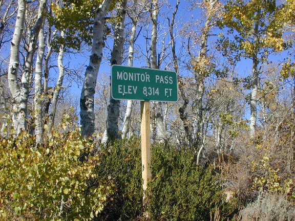
Continue on CA89 over Monitor Pass to the junction with US395. Turn right (south) on US395.
Take US395 south through the Walker River Canyon, through Bridgeport to the turnoff to Bodie (CA270) just south of Bridgeport. Turn left (east) on CA270.
Continue on CA270 for 10 miles to the end of the blacktop. The next/last three miles is washboard gravel. It is rough but negotiable. I usually run about 15-20mph through this section.
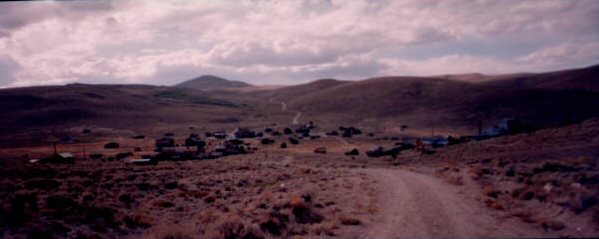
Bodie is an absolutely fascinating gold-mining ghost town. No services except for bathrooms and some bottled water if the museum is open. Well worth the trip. $2.00 per person admission fee; it’s a California State Park:
From Bodie go back the same way you came. (There are alternative routes out but most of them require a 4WD vehicle to negotiate). When you get to the junction of CA270 and US395, turn left (south) on US395.
Continue south on US395, past Mono Lake, to Lee Vining. This is about the half way mark. Food (and lodging if you are doing this trip in two days) are available here.
From Lee Vining, continue south on US395 for about 1 mile to the junction with CA120. Turn right (west) on CA120.
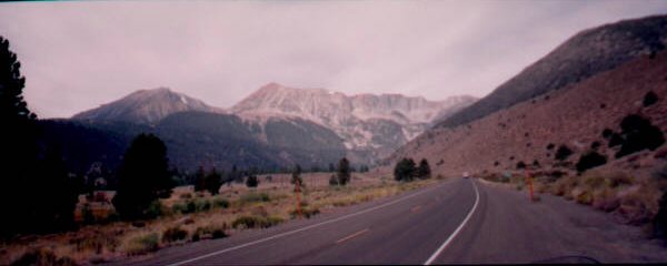
Continue on CA120 over one of the most spectacular stretches of road on the planet, in my view, over Tioga Pass (9945 feet) to the Yosemite east gate:
The entrance fee is either $10 or $20, even on a motorcycle, to get through the park. Save your receipt for when you exit the park.
Continue on CA120 west through Yosemite past Tuolomne Meadows, Tenaya Lake to Crane Flat. Turn left (south) at the stop sign at Crane Flat and go down into Yosemite Valley to see Half Dome, El Capitan, etc.
Continue down into the valley to the stop sign at the junction with CA140. Turn left (east) and continue on into the valley.
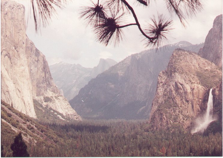
For a spectacular view (from “Valley View”), turn right (south) at the junction with CA41 (Wawona turnoff). Just before the tunnel, turn into the parking lot on either the right or the left side of the road. Watch out for buses, tourists, kids, dogs, etc. This spot is called Valley View and is world famous for its view of Yosemite Valley, El Capitan, Bridal Veil Falls and Half Dome. It is also very busy. It is worth the stop, I think:
When you leave Valley View, go back down hill the way you came. You will go past Bridal Veil Falls (viewable from Valley View) and rejoin the road into the valley. Continue on into Yosemite Valley.
I usually make a stop at Camp Curry for a soda, potty break, etc. I then tour around through the valley, past the campgrounds, past the Ahwanee Lodge, through Yosemite Village and back out the way I came in. Gorgeous scenery; usually a lot of traffic, too (in the valley).
On the way back out, turn right at the junction of CA140 and CA120. Turn right (north) on CA120 back out past Crane Flat.
Continue north on CA120 past Buck Meadows, through Groveland, Big Oak Flat, down a 5 mile nothing-but-curves stretch called Priests Grade, past the Moccasin power plant, past Don Pedro Reservoir.
Continue on CA120 to China Camp and the junction with CA49. Turn right (north) on CA49.
Continue on CA49 to the junction with CA108. Turn right (east) on CA108/CA49.
Continue on CA108/CA49 through Jamestown, past Railtown 1897 (worth a visit if you have time and like trains), to the junction with CA49 just before Sonora. Turn left (north) on CA49.
Continue on CA49 through Sonora. When you get to the deadend at Main Street in Sonora, turn left (north). That is CA49. Sonora is a neat town if you have time to stop.
Continue on CA49 through the gold rush towns of Columbia (slight side trip if you have time – stage coach rides, etc.), Angels Camp (of “celebrated jumping frog” fame), San Andreas, Mokelumne Hill, Jackson, Sutter Creek (neat little town), Amador City, Dry Town, Plymouth (in the heart of the new “wine country”), El Dorado, Diamond Springs and, finally, Placerville.
Gasoline:
You are in the boonies. Gas stops are few and far between. You need to plan your stops fairly carefully, depending on the time of year. The earlier in the spring and the later in the fall, the more distance between gas pumps, particularly in Yosemite.
You will find gasoline in:
Placerville
Camino
Pollock Pines
outside of Sly Park Reservoir
at Kirkwood (this is about 40 miles from Sly Park and is VERY expensive – at least a dollar more per gallon than the prior station).
just beyond Woodfords (about 2 miles south of town at a store back in the woods on the right side of the road; don’t blink or you will miss it – 1 pump, 87 octane only)
sometimes at Markleeville; one time the station is open, the next it is not…
at Walker on US395 (this is about 40 miles beyond the pump near Woodfords)
at Bridgeport
at Lee Vining (this is 51 miles after the last station if you took the side trip to Bodie)
at Tuolomne Meadows in Yosemite during the summer season.
at Crane Flat in Yosemite most of the time (this is 71 miles from Lee Vining; it is about 40 miles into Yosemite Valley and back to Crane Flat – no gas available any more in Yosemite Valley).
Buck Meadows
Groveland
Big Oak Flat
China Camp
Sonora
Jackson
all the gold rush towns north of Jackson except Drytown which really is dry…
Food:
There are stores in a number of locations and restaurants and cafes in most of the towns, villages and hamlets along the way except for Bodie.
Lodging:
There are resorts, motels and campgrounds in many spots along the route except for Bodie.
Speed, time:
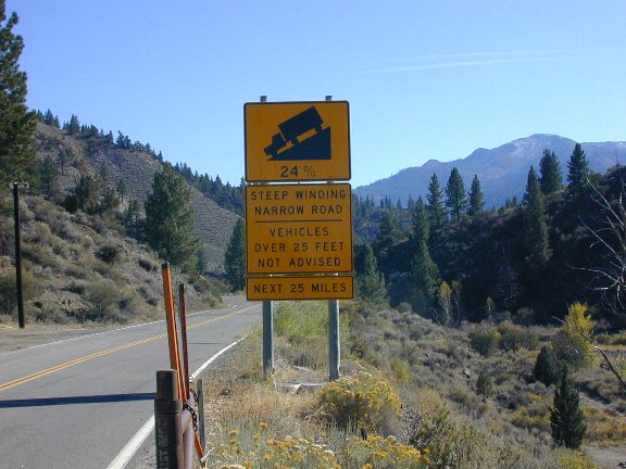
Allow plenty of time. Except for a couple of stretches on Mormon Emigrant Trail and along US395 and CA120, most of this route is winding and fairly slow going. Many stretches are very winding and down to 30-40mph. I can do the whole trip in 14 hours if I stop for 30 minutes at Bodie, 45 minutes at Lee Vining, 20 minutes at Camp Curry and not much else. If you are doing the trip in two days, Lee Vining is about the perfect half-way point. The whole trip is about 450 miles.
Cautions:
Gas stops can be few and far between. Heed the gaps in the above list and you should be OK.
The scenery is so drop-dead gorgeous, I have to be careful not to run off the road. I also have to be careful not to stop too often or I will never get anywhere. Every other corner is a photo-op. You are in, around, over and through the Sierra Nevada mountain range for most of this trip.
You will be going from about a 1000 foot elevation to 10000 feet. The temperatures, even in the summer can range from the high 40s (at Bodie and Tioga Pass) to the 90s (in Yosemite Valley and going north on CA49 through the gold rush towns); you will need to dress accordingly.
Because of the long stretches without services, I usually carry liquid for drinking with me.
Most of the passes on this route are closed in the winter so it pays to check with Cal Trans Road Information before going to be sure that the roads are open.
Summary:
This is a wonderful trip. Gorgeous scenery, wonderful motorcycling, tons of western US history. It is a visual feast. I’ve been over this exact loop 6 or 8 times and never tire of it.
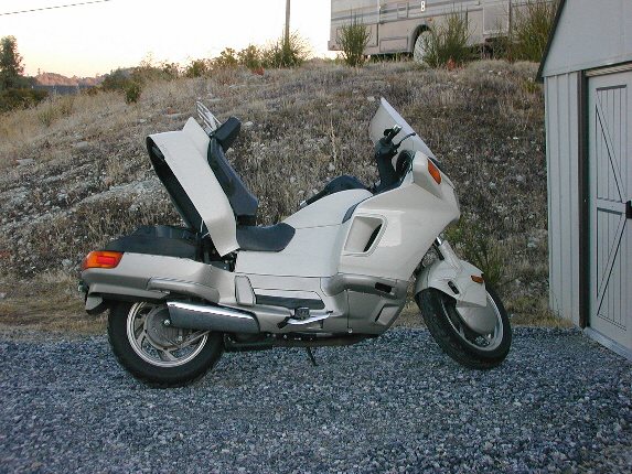
Although the trip can be done in one fourteen hour day, I would recommend doing it over two days. The Honda Pacific Coast is the only motorcycle I’ve ever owned that was comfortable enough to ride that many hours in one day.