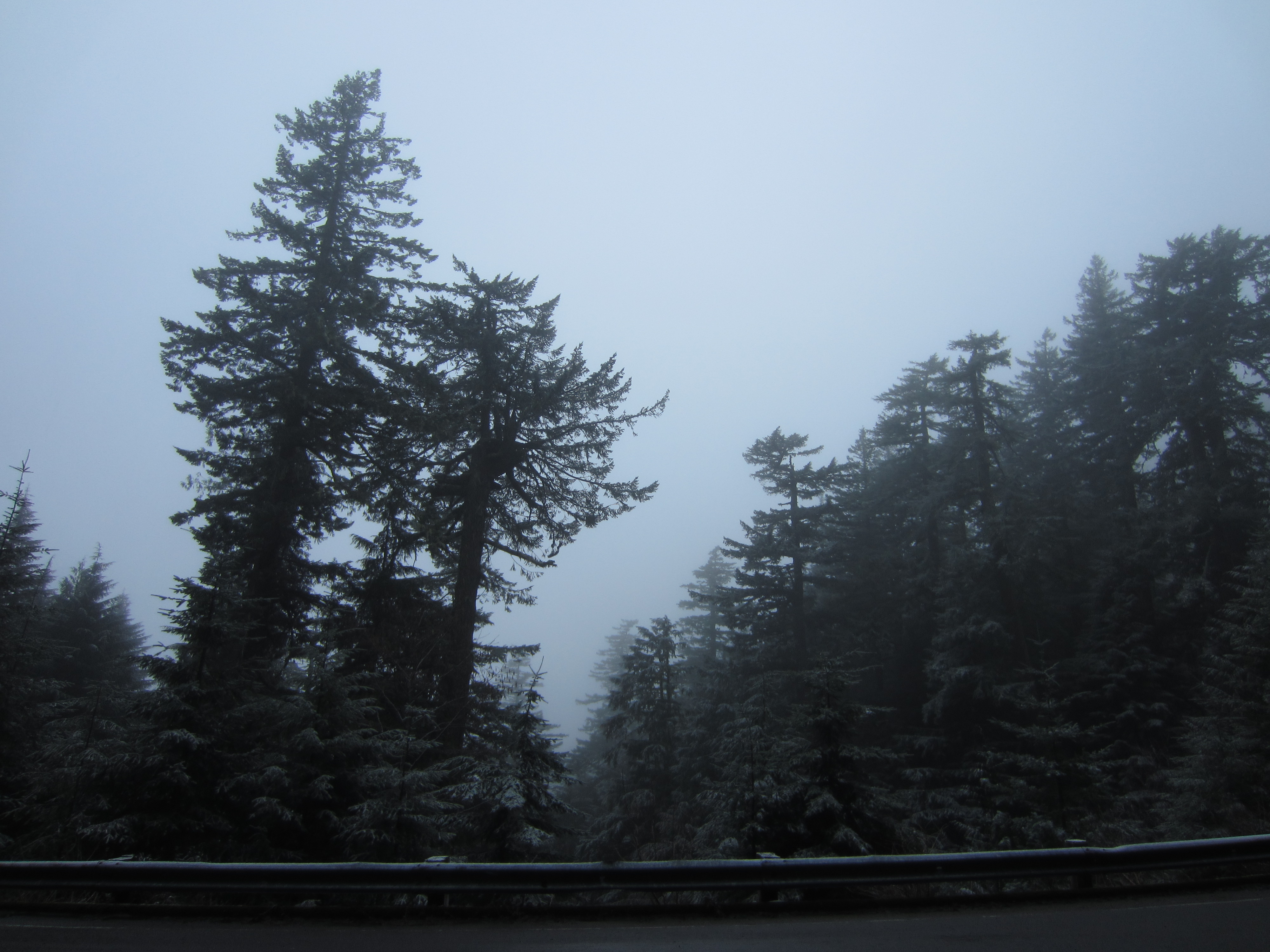
After a dinner at The Woodsman, an interesting lumberjack-themed Thai restaurant in Philomath, Heather and I took a quick trip to the top of Marys Peak. Partway up the mountain we started seeing snowflakes and a dusting of snow on the trees.
Pretty soon we realized we were driving into a big cloud that was producing a snow storm on the top of the peak.
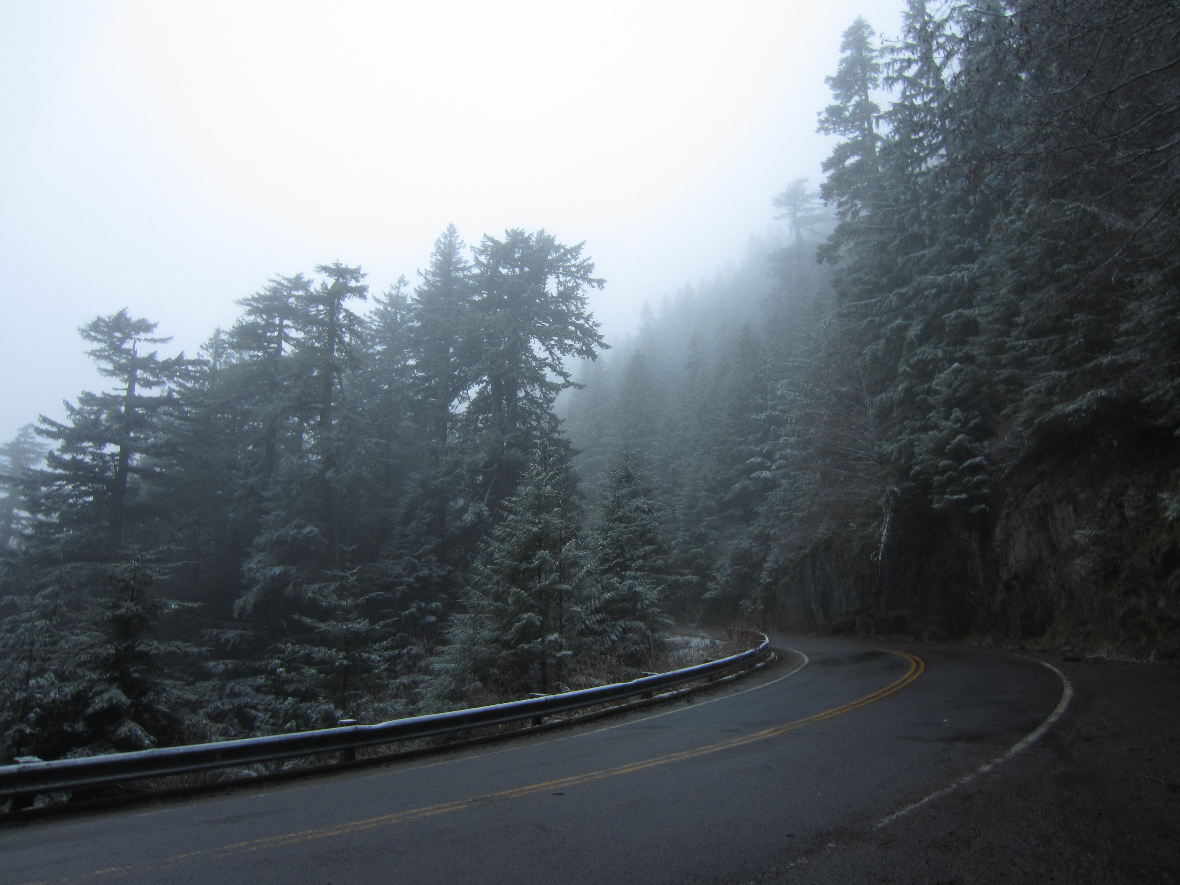
A few weeks ago, this whole road was a few feet deep in snow. In the last week or two it all melted off. The last few days have been cold again. This allowed a bit of snow to fall on Marys Peak again.
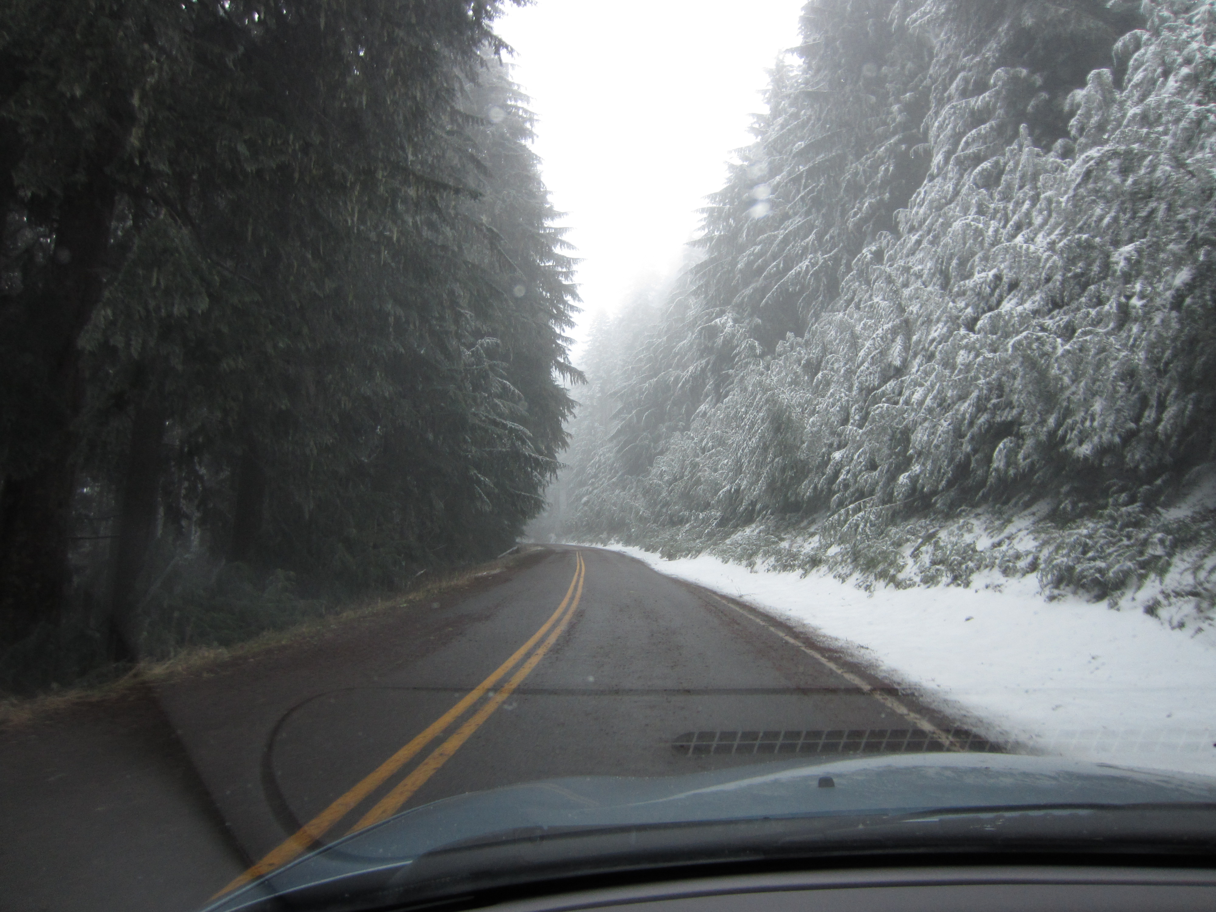
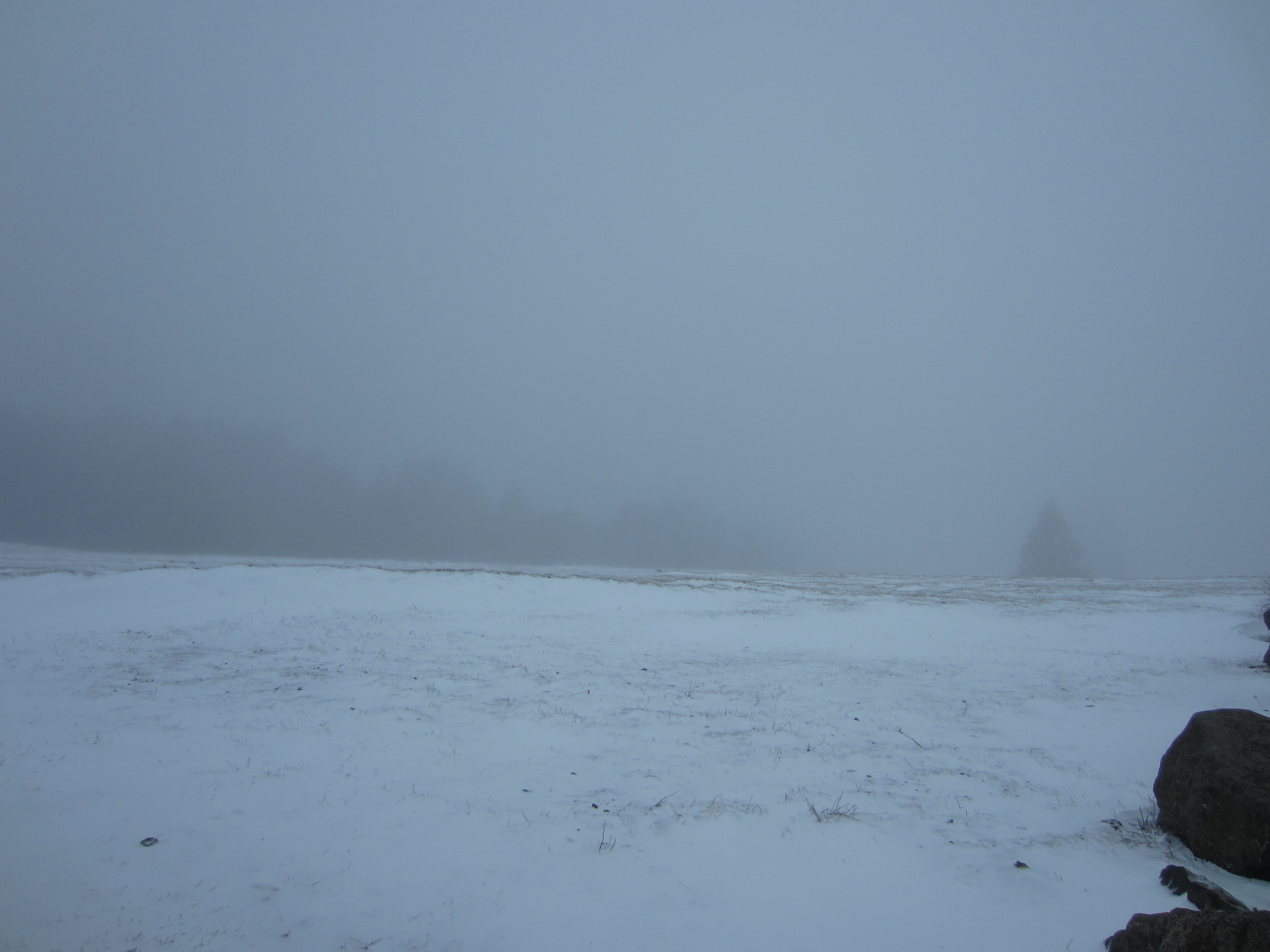
At the upper parking lot on Marys Peak looking toward the summit. The wind was incredibly cold and biting.
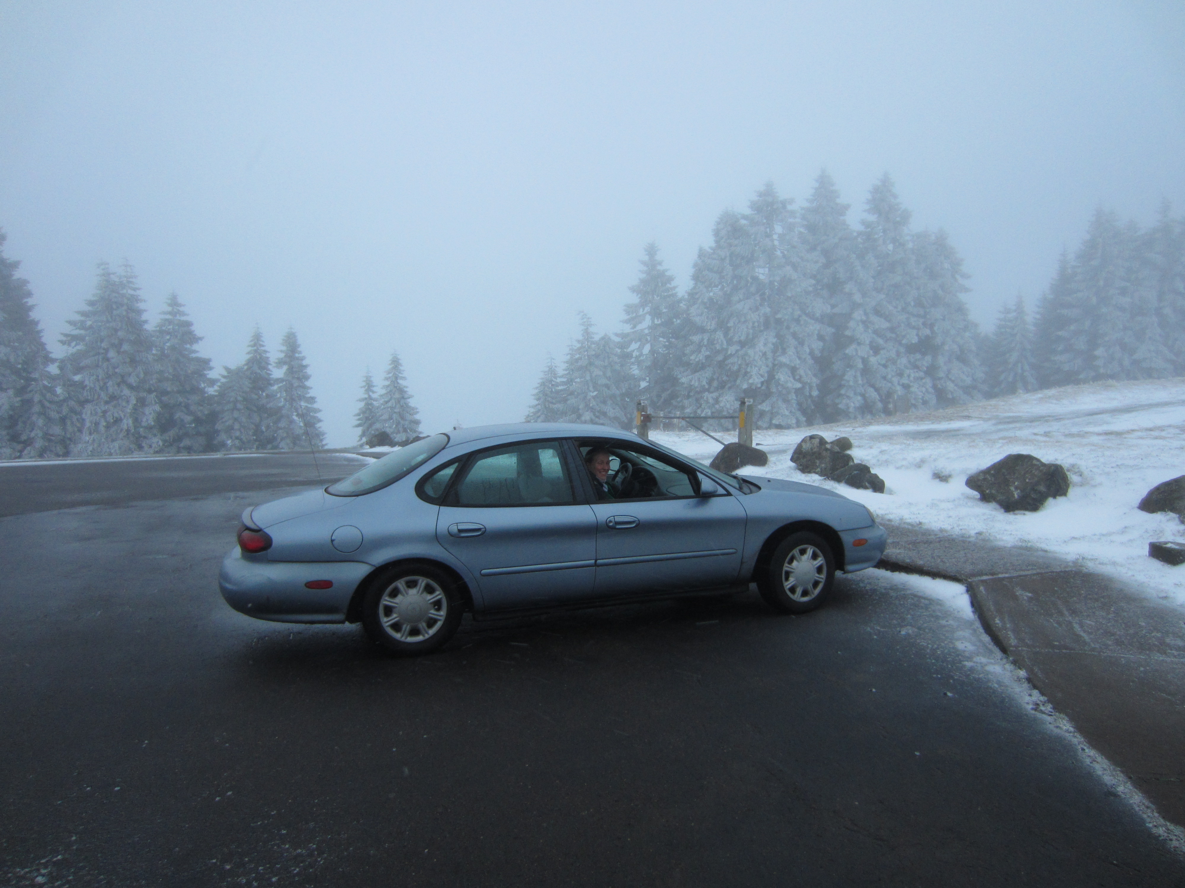
Heather was brave enough to roll the window down for a minute for a quick photo. Corvallis would be visible in the background on a clear day.
Looking west toward where the ocean would normally be.
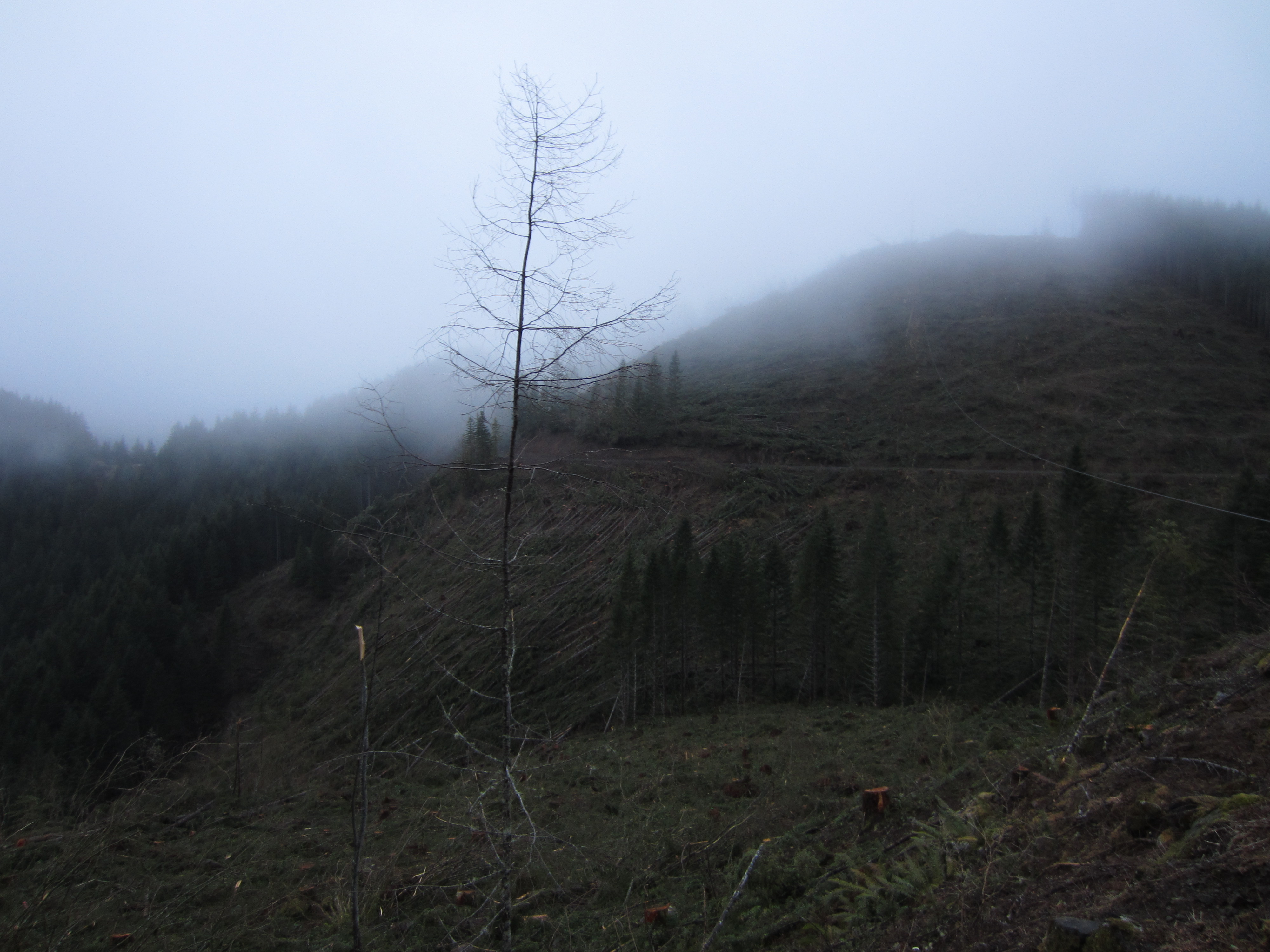
On the way down from the summit we stopped off at a logging operation that has been running for the last several months. Earlier in the winter, the logging outfit was plowing the road to allow log trucks and equipment to pass.
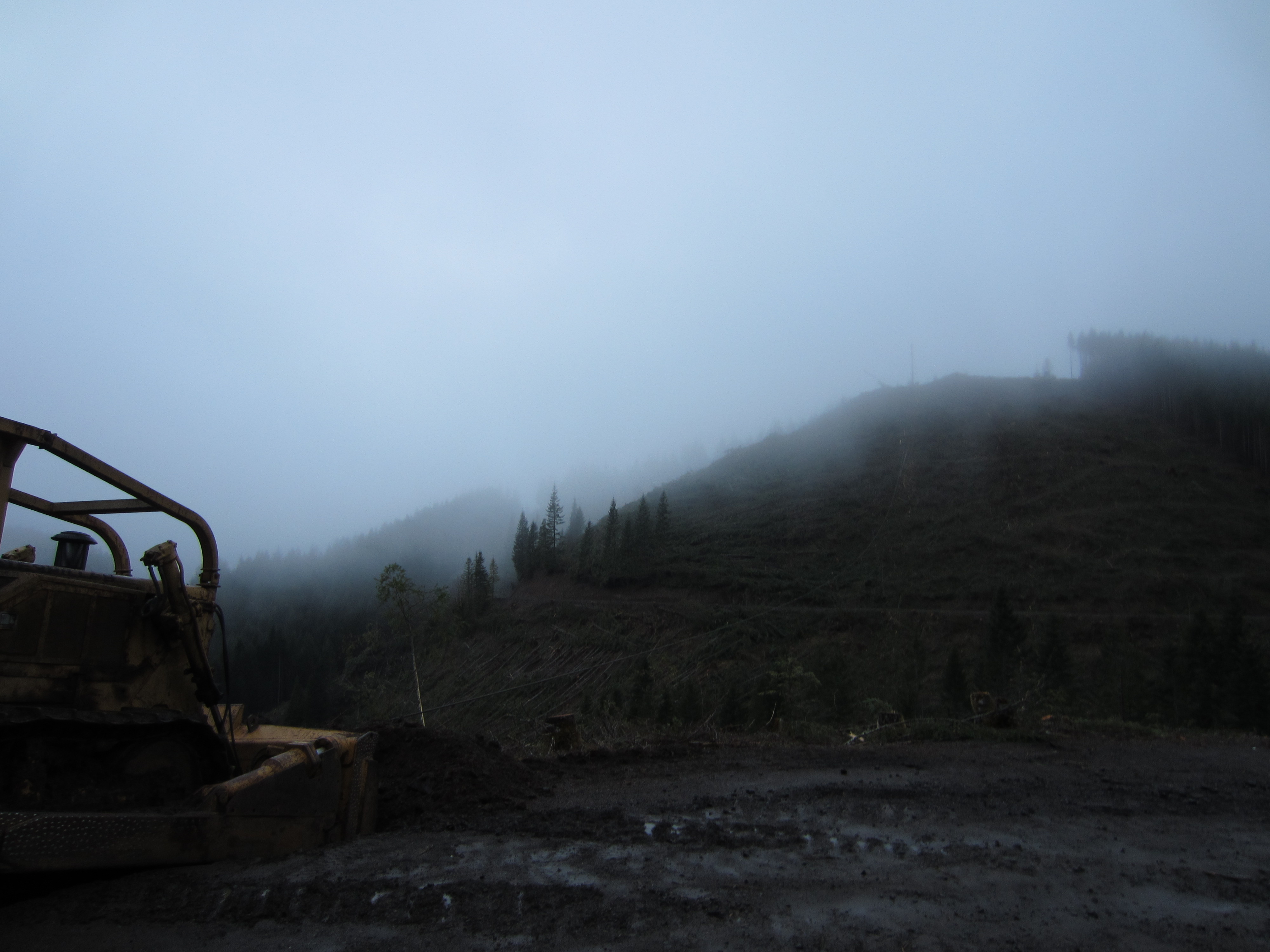
This bulldozer is serving as the anchor for a high line on the logging operation.
Lots of trees have been felled and are awaiting pickup to the top of the hill. This is probably the second or maybe the third time that this forest has been logged.
Hopefully all of the animals escaped before the felling started. It will take another 40-80 years for the forest to regenerate to the point where the timber is merchantable again. It will take many hundreds of years before it is considered old growth.
Another view of the activity. It is rare that the general public gets to see a logging operation like this up close and personal but throughout the coast range and Cascades in Oregon, and in forests all around the world this is the everyday reality. The world needs timber for a variety of things such as to build houses and to make paper. Until some other cheaper way is found to fill these roles, forests will continue to be logged. I am curious how many cycles of cutting can happen before the soils become exhausted and trees stop growing on the land. It seems to me like this would be a finite amount of time. So it goes in the forests of Oregon.
Today Drew and I did some work on his XL185 conversion project. We had the engine turning over but it wouldn’t start and idle. My guess is there are some electrical troubles and the engine probably needs proper intake and exhaust runners. We also replaced the belt, pulleys, and tensioner on my Taurus plus fixed a coolant leak. The time-lapse above shows the fun that we had today.
This past Friday I got the itch to get out of the LA basin. It was only four days into my stint in Pasadena and I already wanted to escape! Having been unsuccessful in finding anyone who wanted to go for an adventure during our first weekend on the CalTech campus, I loaded up the car with a few things and set off on my own.
The first destination was the Angeles Forest Highway. It’s a winding, twisty road that cuts up and over the top of the Angeles Mountains to the east of Pasadena. If only I had a motorcycle!
Heading up the base of the Angeles Forest highwayLooking out into the LA basinThat dark line running across the middle of the picture is the smog layerThe road was carved out of the side of the mountains
As you can see in the video, this road would be an absolute blast to drive with a good motorcycle! The road cleanup signs along the way all represented different motorcycle clubs.
There really are trees above LA!I got my first taste of the desert in the eastern foothills of the Angeles mountains
Welcome to California City! The city stretches over 203 square miles and has about 12000 people living in it. That’s right. It’s the fourth or fifth biggest city by square miles in the USA but it has almost no people. It’s a failed land development scheme from the 50’s.
The main road just outside of downtown California City becomes a little more tenuous
There are hundreds of miles of roads just like that one crisscrossing the desert. No one built on almost any of the land yet it is still all within the city limits. The roads have all fallen into such disrepair that only expert Ford Taurus rally drivers should attempt them.
One of the main boulevards in California CityOne of the many roads to forever in the desert. This was on the Trona Road.Coming into the town of Westend outside of Trona I happened upon a large mineral refining operationThere were these strange pipes running along the side of the road for several miles. They connected one processing plant with another. The air smelled sulfuric.Looking out from the pass on the Trona Wildrose Road into the Panamint Valley. It was already pushing well above 100 degrees when I stopped to take this photo.There is a Radar installation out in the middle of the Panamint Valley. It serves the approach to the China Lake Naval Weapons Center. When I was quite young my parents and I had pulled over near this spot for lunch. We got quite the airshow from two fighter jets doing a sub-100 foot pass down the valley.
I should also note that right after I took this picture and got back on the road a white unmarked truck came up behind me out of nowhere and turned off down the gravel road toward the Radar installation. It seems that even in the middle of nowhere certain facilities are well monitored.
Also down the Radar access road is the abandoned town of Ballrat. Evidently about 300 people camp out in the ruins during the winter months. In the summer one or two people try to make money off the poor wayward tourist who finds the ghost town. I’m sure the government loves all those people driving by their Radar site.
Another 15 or so miles up the road I was passed by an F-16 flying down the canyon toward the Radar site. It was bristling with bombs. Not quite as impressive as when I was a little kid but still pretty neat to see a jet roar down the canyon!
The entrance sign to Death Valley National Park on the Wildrose Canyon road
Another 10 or 15 miles up this road the canyon starts. Shortly after the entrance I stopped to take a photo. The temperature in the canyon felt like it was around 120 degrees. All of the dark rock was reflecting the heat.
Something smelled a bit funny. I looked under my car and saw the transmission bleeding all over the ground! It wasn’t a little drip. It was like I was pouring a quart bottle of transmission fluid on the ground.
Deciding the better course of valor was to turn around and get onto a road that people actually routinely use, I navigated a five-point turn and took off back the way I came. The canyon is very narrow at least in its early stages. Two cars wouldn’t be able to pass.
At the road junction I decided to head for Panamint Springs, 30 or so miles away, in the hopes that I would find cellphone reception or at least some automatic transmission fluid. The only thing I found there was a jug of water in case I broke down and had to wait a few hours for a tow truck. By this point I was on the main road plied by many tourists. And I was getting occasional white clouds of smoke behind my car as the transmission fluid would hit my catalitic converter.
The first cellphone reception I got was about 20 miles outside of Lone Pine. Thinking that I should consult someone who knows things about cars, I called up Dan to get his opinion. From what I described, he thought it might have just been a radiator hose.
The Sierra Nevada mountain range as seen from the Owens Valley
In Lone Pine, about 90 miles from where I initially detected the problem, I pulled into the only service station in town. The clerk at the gas station in Panamint Springs had suggested I try the place. The next closest repair shop was in Independence, another 20 minutes away.
The sign for the repair shop that I stopped at. Miller's Towing and Tires is the only place for miles and miles that can repair a car.The garage at Miller's Towing is an old Quonset hut. Out back they have a few car lifts and to the side they have a bunch of wrecked cars waiting to go to the scrap yard.
We pulled my car up onto a lift in the back and took a look underneeth. At first a large stream of water started flowing out of it. That was quickly traced to the condenser on my air conditioning unit. Next we looked at the drip coming from my transmission. The source was the seal around the transmission oil pump. It was leaking.
The puddle of fluid under the car when we lifted it into the air.It was coming from somewhere up there.
We dropped the car back down off the lift and I pulled it around front. The mechanic went to the office to pull out a few books to see how long it would take to replace the seal. The book said it would take nine hours because the engine and transmission both would have to be removed from the car. At their labor rate, it would cost me $700 for labor. Parts would only run $50. Further, they couldn’t actually do the work until Monday.
Fearing a huge bill and a lengthy stay in Lone Pine, I called around to a few people to get opinions on what I should do. Dan thought that I should dump the car and take the bus back to LA. My parents thought that I should have the shop fix it. Emily helped me find the value of my car. Here’s a hint. It’s not worth anything with a bum transmission!
After a while the shop owner came back and took a look at it himself. He told me that I could either pay them $750 and have it done by sometime next week or that I could wait until it got cool in the evening, put a bunch of transmission fluid in it, and try to drive it back to Los Angeles. Evidently he has seen this same problem many times before on many different cars. In extreme temperatures and under extreme conditions (read: steep roads, high speeds, etc.), the transmission seals will start to bleed fluid. Since I had made it as far as I did, he figured that the seal would reseat itself when it had a chance to cool down. He suggested that I not drive so long and in such harsh conditions with the car in the future.
The option of waiting till nightfall was much more appealing than the alternative of being stuck in Lone Pine, missing work, and having to shell out a lot of money. I paid the shop $40 for their time and expert advice and walked the mile into Lone Pine. There was a NAPA that just happened to sell automatic transmission fluid.
In Lone Pine I found the NAPA auto parts store and bought every quart of Mercon 5 automatic transmission fluid they had. It only amounted to eight quarts! I also procured a funnel and some fix-a-leak stuff for my transmission. Outside the shop there were two classic Harley Davidson motorcycles from the mid 50’s and early 60’s. The owner of the parts store and his buddy rode off on them as I walked down the road. I wish I had gotten a picture. They really were badass bikers just like in the movies.
On my way back to the mechanics garage I stopped in at the Mount Whitney Restaurant. They gave me some strange looks when I walked in carrying a box full of transmission fluid and a funnel. I ordered a cherry malt, a burger topped with chili and bacon, and some onion rings.
My dinner at the Mount Whitney Restaurant
After a long hot walk back to the car I settled in to wait for the sun to set behind the mountains. The wind had picked up a bit which eased the temperature down into the 90’s. As the sun sank I decided it was time to put in the fluid and try to make a break for Los Angeles.
Getting ready to put in four quarts of transmission fluid and a quart of fix-a-leak
The next part of my journey can better be described by watching the videos below. Looking back at these videos I noticed that I seem to start almost all of them by saying “well…” In the future I’ll try to avoid that.
After all the adventure and excitement I managed to make it back to LA without being broken down on the side of the road. Had I broken down where I first noticed the problem, I probably still would be there waiting for someone to come along and rescue me. That is if I had survived the heat of the day. In other words, I would have been vulture food!
This morning I went out to my car to see if it was still leaking fluid. It looked as if about an ounce of fluid had dripped off of the car overnight. I had used a small piece of cardboard under the drip spot to gauge how much had come out.
The cardboard scrap had soaked up most of the transmission fluid that dripped during the night
I watched the drip point for about ten minutes and didn’t see any more drops come out. It appears that at the very least, the leak has been slowed down enough that I should be able to make it back to Oregon in the fall for a transmission repair. Rick appears to have an uncle with a good shop where he and I both can work on our leaking cars in September.
After this car trouble I have a new dilemma. Can I trust the car to take me on outings during the rest of the summer? I really want to get back over toward Death Valley to explore more of the vast nothingness. Vegas isn’t that far away on the freeway and I would really like to go check it out. All sorts of activities within LA require a car to reach. Can I trust my car to not leave me stranded?
For those interested, I have sketched out the route I took. It was just about right on 500 miles. Had I not had my troubles, I would still be in Death Valley checking out the sights and saying “damn it sure is hot.” All of this auto excitement reminds me of when I went with a few friends into the deserts of Tunisia in a rented Peugeot 206.


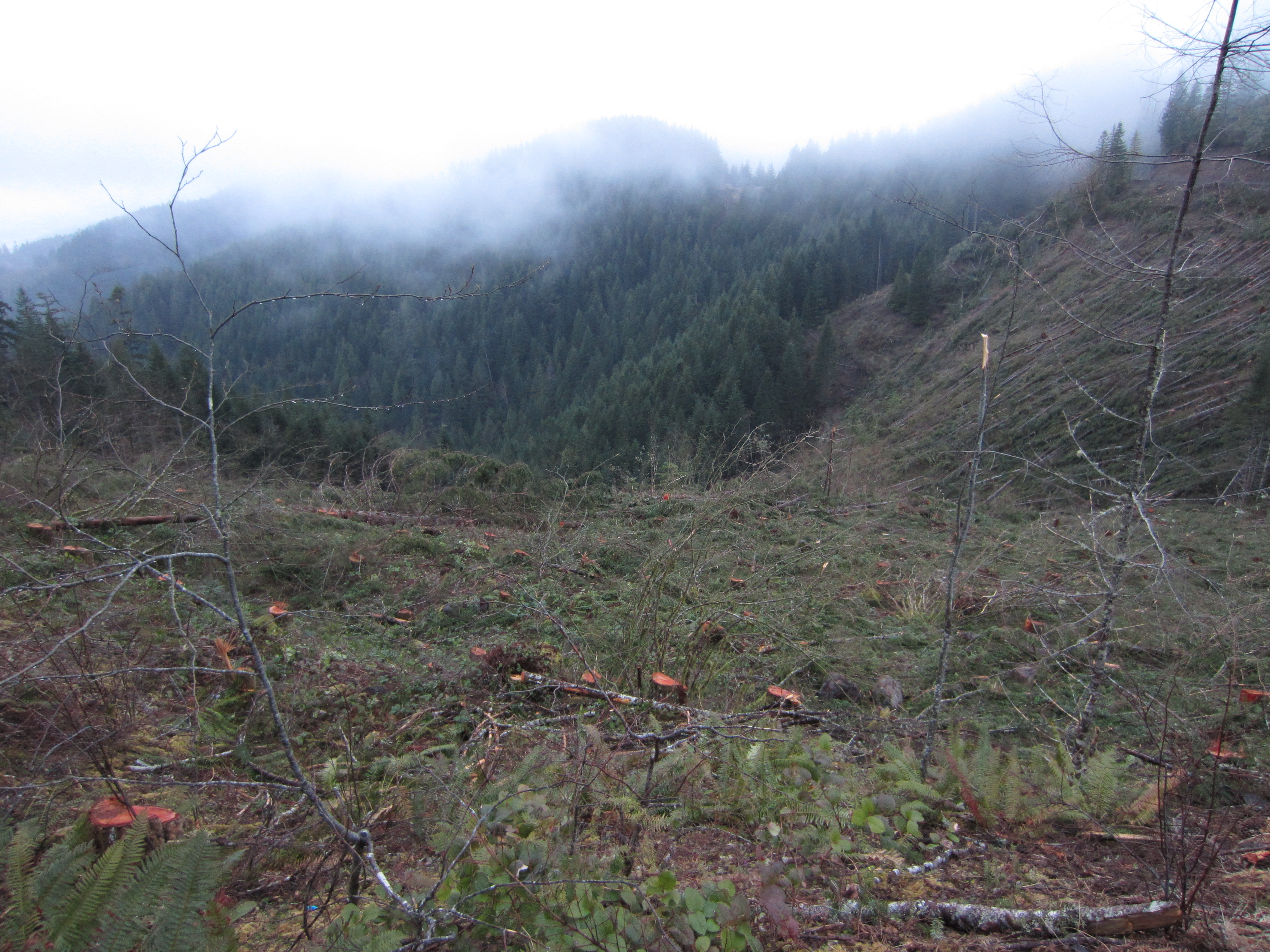
 Another view of the activity. It is rare that the general public gets to see a logging operation like this up close and personal but throughout the coast range and Cascades in Oregon, and in forests all around the world this is the everyday reality. The world needs timber for a variety of things such as to build houses and to make paper. Until some other cheaper way is found to fill these roles, forests will continue to be logged. I am curious how many cycles of cutting can happen before the soils become exhausted and trees stop growing on the land. It seems to me like this would be a finite amount of time. So it goes in the forests of Oregon.


